Moments
Idiosyncratic Collisions Between the Urban Fabric, Military Structures, and Political Boundaries
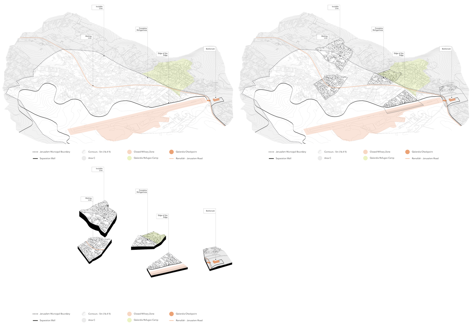
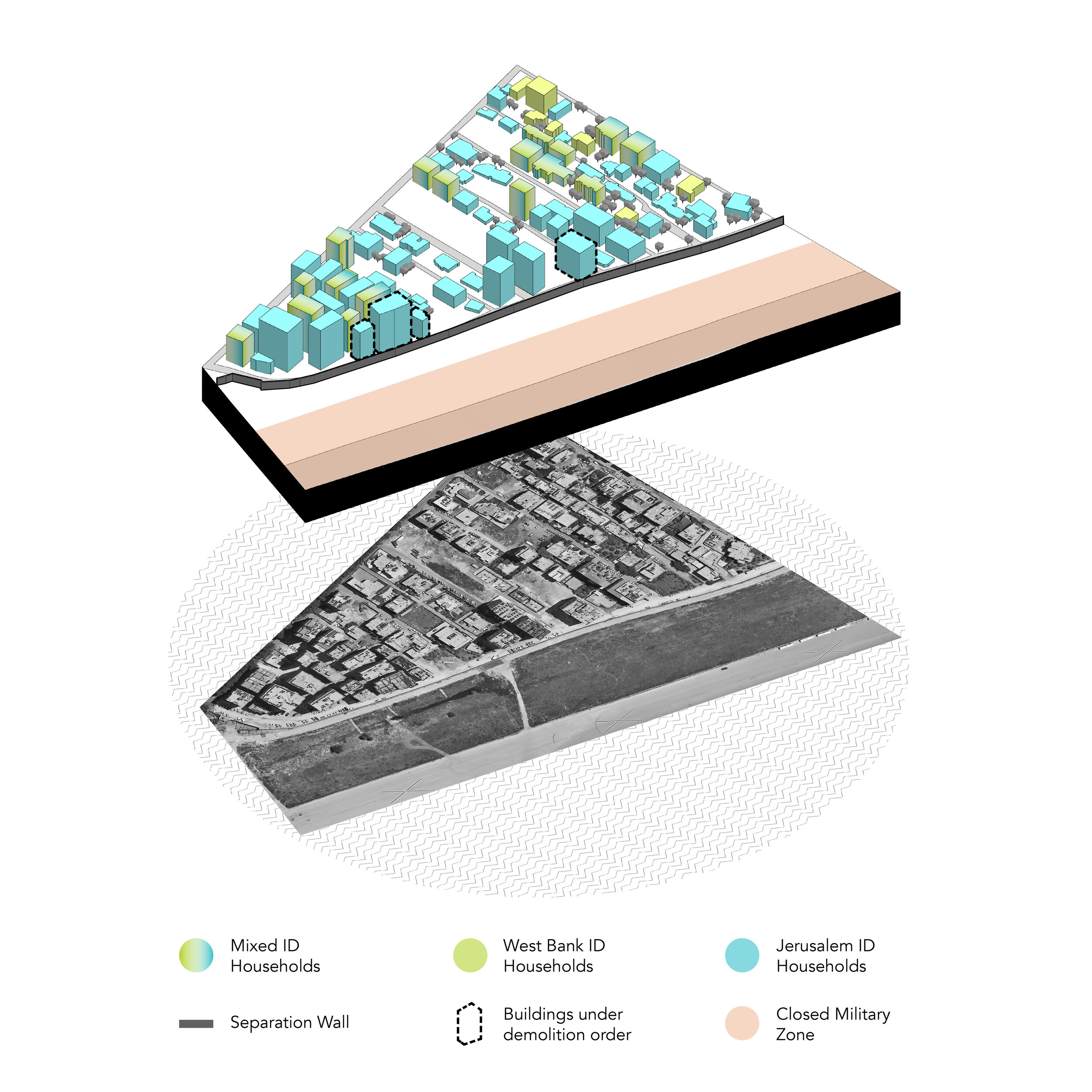
Each moment represents an urban condition at a certain moment in time. And each condition is defined by the collision between the urban fabric with different colonial military structures and/ or political boundaries. Codifying buildings with ID colors reveals the way in which those territorial structures and boundaries work in parallel with the colonial policies to determine where Palestinians live. To fully understand what’s at stake, possible futures are envisioned for each moment- whether the decision to excise Kafr Aqab from Jerusalem is made tomorrow, in ten years, or twenty.
Building boundaries and heights were traced from an aerial photo taken in 2018 obtained from the Ministry of Local Government.
Military structures and boundaries are a combination of GIS layers from the Ministry of Local Government, interactive map project done by B’Tselem, and one UN map.
Building codification was estimated based on a study done in 2018 by the Jerusalem Institute for Policy Research, which estimates one third of the apartment units to be inhabited by mixed-ID families.
Urban infill and vertical densification are based on the examination of current development patterns.
Each projected circle has a radius of 1,000 ft.
[In]Visible Line
The invisible city boundary of Jerusalem determines where Palestinian Jerusalemites can establish a home. The city boundary here is a permeable line which operates as the edge of the ledge, where crossing it is considered defiance of the “Center of Life” law. While inside the boundary is currently highly desirable, outside it is classified as Area C, which bans Palestinians from construction without Israeli permission.
Excision will result in shifting the city boundary to align with the Separation Wall, probably transforming the area into Area C (or some equivalent) in order to consolidate control and prohibit further construction. The longer the excision process takes, the more visible this boundary becomes.
Waiting Line
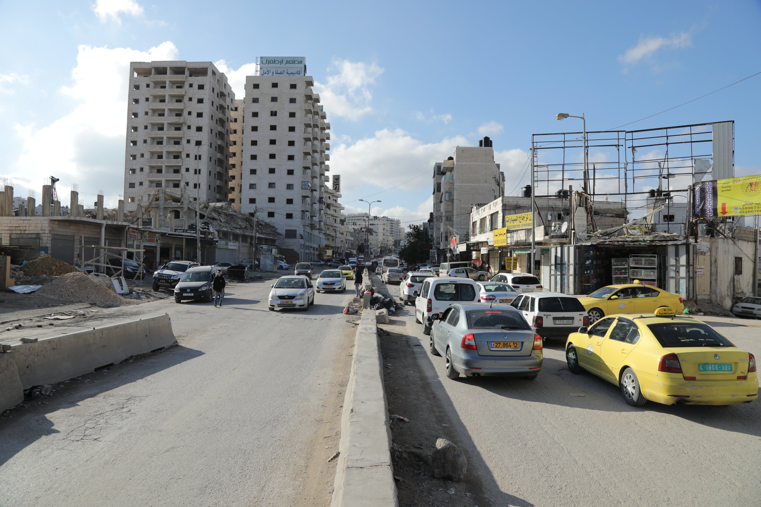
Ramallah – Jerusalem Road is the spine of Kafr Aqab. It is the road Palestinians take to travel From Ramallah to Jerusalem, Bethlehem, Hebron, and Jericho. The traffic on this road is multiplied due to Qalandia Checkpoint, which has transformed it into a commercial corridor that serves both neighborhood inhabitants and passersby. Palestinians can spend up to 3 hours a day waiting in this canyon of waste and billboards.
Long-term excision will result in exacerbating the situation. With complete neglect from the municipality of Jerusalem, upgrading the infrastructure or providing waste management to accommodate the urban growth and increasing traffic is improbable.
Complete Refugeeness
The city boundary here divides displaced Palestinians of two time periods within the Israeli colonial project. Palestinian refugees living in Qalandiya Refugee Camp arrived here in 1949 after being dispossessed from their homes in Jerusalem, Haifa, Lydd, Ramleh, and west of Hebron. Inside the boundary are Palestinian Jerusalemites being displaced right now. Since the refugee camp was established long before this part of Qalandia became a destination for development, its presence remains much stronger and therefore the boundary is much less visible.
It is less likely for developers to build near the refugee camp since the area is less desirable. However, as the situation persists, developers will start running out of options and densification will eventually reach the edge of the camp.
Edge of the Edge
As seen in ‘Morphology’, the Separation Wall was built around existing buildings, and urban infill and vertical densification have been following the route of the Wall since. The Wall separates this area from the former Qalandia airport. Currently classified as a “closed military zone”, the motion of transforming the area into a massive Israeli settlement has been formalized in February 2020 (Peace Now 2020). The Israeli government has issued demolition orders for four buildings that are too close to the Wall (OCHA 2017).
Verticality at the edge of the edge will probably be determined by the proximity to the wall, where the further away from the wall, the higher a building can be. Excision will equate the Separation Wall with the city boundary in this case.
Bottleneck
The moment the city boundary and the Separation Wall intersect is where the checkpoint of Qalandia emerges. This is the point where all traffic reaches its highest level, whether Palestinians are driving, taking public transportation, or walking, whether they actually need to cross the checkpoint or not, and whether they have West Bank IDs, temporary permits, or Jerusalem IDs. Palestinian lives revolve around this checkpoint to the point where social media accounts were made to report live traffic updates. This point also operates as the end destination for Palestinian protests where it has become a site for shooting by Israeli military forces.
Since this area is outside the city boundary and lies within Area C, no new construction can be predicted. However, the exponential growth of the population will probably lead to the expansion of the checkpoint to accommodate the traffic.
The Future is Here
Shifting from the Urban to the human scale, this section is a collaboration with Palestinian Jerusalemite photographer Samer Sherif. Sherif investigates these critical moments on the ground and with his lens, captures social, urban, and infrastructural features emerging due to the ongoing metropolization of Kafr Aqab. Those photos are a manifestation of and a glance into the future awaiting Kafr Aqab.


